Beach Park vs. Sunset Park: How South Tampa's Two Waterfront Neighborhoods Compare on Lots, Flood Zones, and Price per Foot
Should you buy in Beach Park or Sunset Park?
Beach Park and Sunset Park sit side by side on the Old Tampa Bay side of the South Tampa peninsula, and both offer canal-front homes, private docks, and a mix of original houses and elevated new construction. Beach Park is the older neighborhood — platted in the 1920s with winding, tree-lined streets and the shortest drive to the Westshore business district and Tampa International Airport. Sunset Park was built out largely after World War II, with deep-water finger canals dredged in the 1950s and a larger share of mid-century homes now cycling through teardown and rebuild. The right choice usually comes down to product tier: which neighborhood has the lot, water exposure, and elevation profile that fits what you're actually buying.
Buyers shopping the $2M–$12M band in South Tampa almost always end up touring both neighborhoods in the same week. They share a shoreline, a housing stock in transition, and a price conversation dominated by the same two variables — land and elevation.
But they are not interchangeable. The differences show up in the plat maps, the canal engineering, and the way each neighborhood's inventory is turning over. Here's how I walk clients through the comparison.
What you're actually choosing between
Beach Park is one of South Tampa's original planned neighborhoods. The Beach Park Company platted it in 1924, and you can still see remnants of one of the original gate sets near Swann and Lois. The street grid curves — unusual for Tampa — under a mature oak canopy, running roughly from Kennedy Boulevard south toward Beachway Drive, with Old Tampa Bay on the west and Lois Avenue on the east.
That 1920s origin shapes the inventory. Beach Park carries a layered housing stock: a handful of Mediterranean Revival originals, a broad band of mid-century construction, and successive waves of custom rebuilds. The waterfront section — Beach Park Isles — runs on canals and bayous cut in the neighborhood's early era, and the adjacent Culbreath Bayou area extends the same water-oriented pattern.
Beach Park's other structural advantage is position. It sits at the northern edge of South Tampa's bayfront, which puts the Westshore business district, International Plaza, and Tampa International Airport minutes away via Kennedy Boulevard. For buyers who fly weekly, that proximity is often the deciding factor.
Sunset Park picks up where Beach Park Isles ends and runs south to El Prado, between Old Tampa Bay and Manhattan Avenue. It's a post-war neighborhood at heart. In the 1950s, developers dredged a cluster of finger canals — locals call the cul-de-sac islands "the fingers" — creating a concentration of deep-water canal lots that didn't exist in the 1920s plats. Local waterfront guides describe the main channels in Sunset Park Isles as among the widest and deepest residential canals in South Tampa.
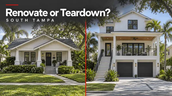
Sunset Park's mid-century ranch stock is exactly what the teardown market feeds on, which is why the neighborhood has one of the most active rebuild pipelines in South Tampa. Street by street, you'll see original one-story homes next to new elevated construction — often three or four of each on the same block.
If you already own in one of these neighborhoods and are watching the rebuild wave around you, the same dynamics drive the sell-side timing question — I've written separately about whether now is a good time to sell in Beach Park.
Waterfront exposure and boating
Both neighborhoods front Old Tampa Bay, so open-water access is comparable once you clear the canals. The difference is the canals themselves.
Beach Park's waterfront follows its 1920s engineering — canals and natural bayous with varied widths and depths, plus some open-bay frontage. Sunset Park's 1950s dredge work produced more uniform finger canals, and the main channels in Sunset Park Isles accommodate substantial vessels.
Either way, waterfront due diligence in these neighborhoods is property-specific, not neighborhood-level:
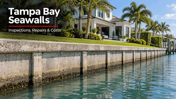
- Seawall condition and age — especially relevant after the 2024 storms; replacement is a six-figure line item on many canal lots
- Water depth at your dock at low tide — canal position matters more than neighborhood name
- Permitted dock and lift status — confirm permits transfer clean at closing
- West-facing exposure — Sunset Park's name is earned; many of its canal lots look straight into the sunset over the bay
Flood zones, elevation, and the two-tier market
This is where the comparison gets serious, and where the two neighborhoods look most alike.
Large portions of the low-lying and waterfront blocks in both Beach Park and Sunset Park sit in FEMA special flood hazard areas — typically zone AE, though the designation is parcel-specific and worth confirming on FEMA's flood map service. Hurricane Helene's September 2024 surge — measured at roughly six to seven feet at Tampa Bay gauges, with higher estimates in spots — flooded low-lying waterfront blocks across South Tampa's bayfront, including in both neighborhoods. Older slab-on-grade houses took the worst of it; elevated new construction generally performed as designed.
That event accelerated a split that was already underway. Both neighborhoods now run a two-tier market:
- Older, non-elevated homes — priced increasingly on land value, exposed to flood-insurance escalation, and subject to the FEMA substantial-improvement rule: renovations reaching 50% of the structure's market value trigger full flood-code compliance, including elevation
- Elevated new construction — built with the lowest floor at or above base flood elevation plus freeboard (the Florida Building Code requires at least one foot above BFE, some jurisdictions require more, and the parcel-specific number comes off the elevation certificate), commanding a distinct price tier and a different insurance profile
Elevation varies block by block in both neighborhoods, not just at the waterline. Before writing an offer on any home here, I have clients pull the FEMA flood zone determination, review the seller's elevation certificate if one exists, and get an actual flood-insurance quote — not an estimate — during the inspection period.
Price per foot, lot values, and what the numbers actually tell you
Here's the honest caveat first: neighborhood-level price statistics in Beach Park and Sunset Park are built on small monthly samples — often a dozen or fewer closings — so the medians swing hard from month to month.
March 2026 neighborhood data illustrates the point: it showed Beach Park's median sale price around $1M with homes averaging roughly 148 days on market, against a Sunset Park median around $1.5M and roughly 71 days — on just 14 and 26 closings respectively, while the two neighborhoods' price-per-foot medians moved in opposite directions year over year. Treat every one of those numbers as directional, not gospel.
The reason the blended medians mislead is the two-tier market itself. A month heavy in elevated new-construction closings prints a high price per foot; a month of original-condition sales prints a low one. Neither number describes the house you're bidding on.
Land is the steadier signal. Teardown-caliber lots in Beach Park and Sunset Park have generally traded in a band from under $1M to $3M+, with canal-front and open water-views commanding the premium — and builders set their maximum lot price by working backward from the finished home's value: projected sale price minus construction, demolition, carrying costs, and target profit. If your plan is to buy dirt and build, that residual-value math — not the neighborhood median — is your real comp. Start with a look at new construction homes in Tampa Bay, and for buyers going the build route, my team's development services work covers lot sourcing, builder coordination, and feasibility.
So when clients ask which neighborhood is "more expensive," my answer is: compare like against like. An elevated new build on a Sunset Park finger canal against an elevated new build on a Beach Park bayou lot. An original ranch on an interior Beach Park street against its Sunset Park counterpart. Run the comparison inside the same product tier and the price gap usually narrows to specifics — lot width, water depth, elevation, and finish level.
Frequently Asked Questions
Which neighborhood has better boating access, Beach Park or Sunset Park?
Both front Old Tampa Bay, so open-water access is comparable. Sunset Park's 1950s dredged finger canals — especially in Sunset Park Isles — offer some of the widest and deepest residential channels in South Tampa, while Beach Park's older canals and bayous vary more lot to lot. For any specific property, verify water depth at low tide, seawall condition, and permitted dock status rather than relying on the neighborhood name.
Why is price per square foot so volatile in Beach Park and Sunset Park data?
Both neighborhoods close a small number of sales each month across two very different product tiers — original mid-century homes priced near land value and elevated new construction priced at a premium. A shift in which tier dominates a given month moves the blended median dramatically. Compare homes within the same tier instead of relying on neighborhood-wide averages.
Did Beach Park and Sunset Park flood during Hurricanes Helene and Milton?
Yes. Helene's record September 2024 surge — measured at roughly six to seven feet at Tampa Bay gauges — flooded low-lying and waterfront blocks across South Tampa's bayfront, including in both neighborhoods, hitting older slab-on-grade homes hardest. Elevated newer construction built to current base-flood-elevation-plus-freeboard standards generally fared far better, which is one reason the elevation split now defines both markets.
What does a teardown lot cost in Beach Park or Sunset Park?
Teardown-caliber lots in these neighborhoods have generally traded from under $1M to $3M+, with canal-front lots commanding the top of the band. Builders price lots by residual land value — the projected finished-home value minus construction, demolition, carrying costs, and target profit — so lot pricing tracks the new-construction market more closely than the resale market.
Do I need an elevation certificate before buying in either neighborhood?
You should review one before your inspection period ends. The elevation certificate documents the home's lowest floor relative to base flood elevation, which drives your flood-insurance premium and tells you whether a renovation plan could collide with FEMA's substantial-improvement rule. If the seller doesn't have one, a Florida-licensed surveyor can produce it, and getting a bindable flood-insurance quote at the same time is recommended.
The short version: Beach Park gives you the older plat, the layered architecture, and the fastest run to Westshore and the airport; Sunset Park gives you the deep-water fingers, the heavier rebuild pipeline, and west-facing sunset water. Both share the same flood-zone reality, and in both, the elevation tier you buy into matters more than the neighborhood median.
If you're comparing Beach Park and Sunset Park — or weighing an original home against an elevated new build on either side of the line — a direct conversation usually clears more up than another search.
About Shane Vanderson
Shane Vanderson is a License Partner and Broker Associate with Engel & Völkers South Tampa, licensed since 2012 representing buyers and sellers across Tampa Bay's luxury market. He specializes in South Tampa, Harbour Island, Hyde Park, Sunset Park, Beach Park, Virginia Park, Culbreath Isles, Westshore Marina District, Bayshore Beautiful, Davis Islands, Avila, Safety Harbor, Odessa, Lutz, Westchase, Riverview, Venetian Isles, Old Northeast, Snell Isle, Gulf Beaches, Downtown St Petersburg, Downtown Tampa waterfront, and luxury condominiums, and holds membership in Engel & Völkers' Professional Athlete Advisory. Connect with Shane at shanevanderson.com or 813-205-5430.
This article is for general informational purposes and is not flood-insurance, engineering, or legal advice. Flood zones, base flood elevations, and insurance requirements are parcel-specific — verify them with FEMA's flood map service, a licensed surveyor, and your insurance advisor.Categories
- All Blogs (212)
- 345 Bayshore (4)
- 400 Central (3)
- Apollo Beach (24)
- Arbor Greene (6)
- Art House (1)
- Avila (37)
- Ballast Point (16)
- Bayshore Beautiful (15)
- Beach Park (49)
- Bel Mar Gardens (7)
- Belleair Beach (8)
- Brandon (15)
- Carrollwood (35)
- Channel District (7)
- Cheval (22)
- Clearwater (50)
- Clearwater Beach (26)
- Cordoba Ranch (6)
- Cory Lake Isles (5)
- Culbreath Isles (27)
- Davis Islands (56)
- Downtown St Petersburg (29)
- Downtown Tampa (53)
- Golfview (20)
- Grand Central at Kennedy (2)
- Gulf Beaches (23)
- Harbour Island (53)
- Hillsborough (2)
- Home Buying (72)
- Home Improvement (6)
- Home Selling (72)
- Hotel ORA (2)
- Hunters Green (13)
- Hyde Park (48)
- Hyde Park House (3)
- Indian Rocks Beach (14)
- Ladera (8)
- Lakewood Ranch (7)
- lutz (43)
- Luxury Homes (40)
- Madeira Beach (32)
- Marina Pointe (21)
- New Suburb Beautiful (7)
- New Tampa (15)
- Odessa (37)
- Old Northeast (11)
- ONE St. Petersburg (5)
- ONE Tampa (6)
- Palma Ceia (20)
- Parkland Estates (8)
- Pasco (1)
- Pendry Tampa (11)
- Pinellas Condos (16)
- Plaza Harbour Island (5)
- Professional Athlete Advisory (3)
- Reviews (2)
- Ritz-Carlton Tampa (16)
- Riverview (26)
- Safety Harbor (7)
- Saltaire (5)
- Seminole Heights (23)
- Skypoint (6)
- Snell Isle (30)
- South Tampa (106)
- St Pete Beach (29)
- St Petersburg (74)
- Sunset Park (41)
- Tampa (94)
- Tampa Bay New Construction (7)
- Tampa Bay Real Estate (27)
- Tampa Bay Waterfront (9)
- Tampa Condos (21)
- Tampa Edition (8)
- Tampa Palms (17)
- The Nolen (2)
- The Place Channelside (2)
- Tierra Verde (21)
- Treasure Island (13)
- Venetian Isles (24)
- Viceroy Clearwater Beach (3)
- Virginia Park (19)
- Waldorf Astoria St Petersburg (5)
- Water Street (17)
- Waterleaf (4)
- Westchase (33)
- Westshore Marina District (21)
- Westshore Yacht Club (6)
- Ybor (8)
Recent Posts